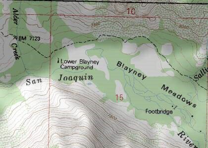
Blayney (Blaney) Meadows
Location: N 37.24327 and W -118.89761
Find on Google Earth
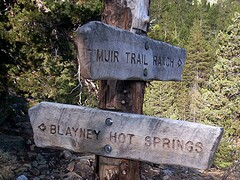 Blayney HotSprings sign (Rick McCHARLES [779]) |
See US Blayneys.
"Blayney Meadows" was approved as the name for the "Hidden Valley" Meadows by the United States Board on Geographic Names in 1971 [740]. It is named after and commemorates William Farris Blayney, who grazed sheep their in the 1870s.
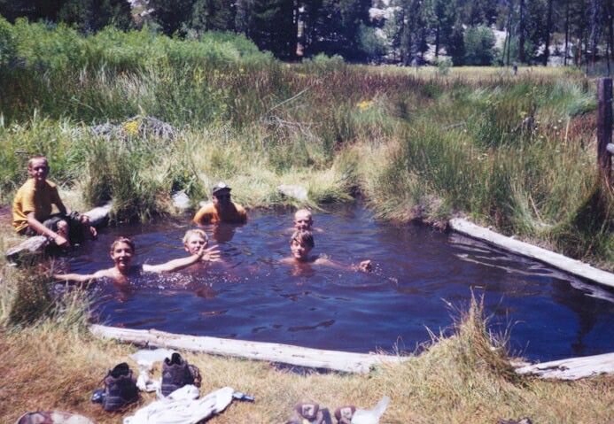
The "extremely popular" Blayney Meadows Hot Springs are "About a mile above the upper end of Blaney (sic) Meadows" [740]. Bathing pools were apparently dug out at three or four springs [740]. Backhurst describes it as "... a wonderful public hot-spring pool in a little meadow.....An early morning soak here, watching butterflies flitting over the dew-spangled meadow - well, it doesn't get much better." [746]
This is recommended as a late-summer destination because of a dangerous ford on the South Fork San Joaquin River [741] [743]
Described as "A vast flat, grassy, and wet area spreads below big granite slopes dotted with ponderosa and juniper.... [742]
Here are some pics from various websites about Blayney Meadows & Hot Springs: | ||
 Blayney Meadows on the John Muir Trail |
 Blayney Meadows by Rob Derubeis |
 |
Click any picture to enlage. |
||
There is some excellent White water kayaking - "The last 2.5 miles from Blayney Meadows to Florence is reported to be excellent class 4 & 5 and the best whitewater on this section of the south fork." [americanwhitewater.org [744]]
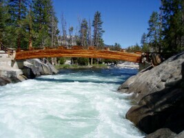 Bride Bridge over South Fork San Joaquin |
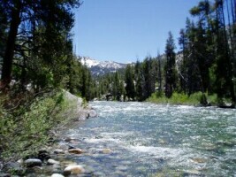 Class II above Blayney Meadows |
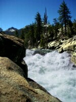 Last rapids (below) |
Photos: Trevor Haagenson 2004 [744] [745]. See more of Trevor's pics: [745] |
||
Keith Blayney