
Blayney Locations in Mongommeryshire around Gregynog
- Aberbechan: 4km N.E. of Newtown, within the parish of Llanllwchaiarn (q.v.), on confluence of Bechan & Severn Rivers
- Aberhafesp: (Aber-Hafesp) 4km N.W. of Newtown at the confluence of the river Hafesp with the Severn.
- Berriew: (Aber-rhiw) 12km N.E. of Newtown (9km E.N.E. of Tregynog & 5.5Km N.W. of Montgomery), situated at the confluence of the river Rhiw with the Severn.
Includes the townships of Allt [Allt Ucha (high) & Allt Isa (low)], Brincamisir (Bryncaemeisir), Brithdir, Ffrydd (Fridd) or (Fridd Penywern), Garthmill (Garthmyl), Keel (Cil), Keelcochwyn (Cilcochwyn), Llandinir, Llivior (Llifior), Penthryn, Trwstywelin (Trwstllewelyn), Vaynor (Faenor) Issa, and Vaynor (Faenor) Ucha. [252] - Bettws Cedewain: (=Prayer house of Cedewain) about 5Km N.E.N. of Newtown, (4km E.S.E. of Gregynog). Until 1914, most properties in the village belonged to the Gregynog estate. See an aerial photo of Bettws Cedewain
Includes the townships of Dilforwyn (Dolforwyn), Garthgellin, Llanitheon, and Ucheldre. - Gregynog: A large country hall 7km N.W.N. of Newtown (2km S.W. of Tregynon. Traditional seat of the Blayney family
- Llandinam: 8.5km SW of Newtown.
Includes the townships of Banhaglog, Carned, Dethynydd, Eskirmaen, Gwernerim, Hengynwydd, Maesmawr, Rhydfaes and Trewythan.
Learn how to say Llandinam ('Llan–din–am') in Welsh!!
["Ll" is an aspirated "L". That means you form your lips and tongue to pronounce "L", but then you blow air gently around the sides of the tongue instead of saying anything. Got it? Some think this is actually said Cl, (1st syllable would be Clan, and it sounds like this, but the Welsh deny it. Some Welsh don't bother, they just use Lan, others say it Hlan and the name Llewelyn Hloo-el-in ]. - Llanwnog: 9km West of Newtown.
Includes the townships/hamlets of Caersws, Castle and Esgob, Moat Lane, Surnant, Uchllawrcoed, Uwch-Llawr-Coed and Weeg. - Llanllwchaiarn: (Llanllwchaearn) 2km N.E. of Newtown, situated on the banks of the river Severn and the Montgomery canal. "Llan" = "church" and "Llwchaiarn" = "St Llwchaiarn from Bangor-on-Dee, an obscure Sixth Century Saint (ap Caranfoel ap Cyndrin, Prince of Powis)".
Learn how to say Llanllwchaearn in Welsh!!
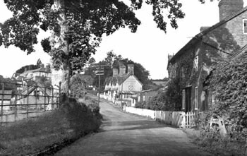
Includes the townships of Aberbechan:, Gwestydd, Hendidley, and Kilcowen. See an aerial photos of Newtown (a), Newtown (b) and Newtown (c) - Tregynon: 7km north of Newtown, 2km N.E. of Gregynog.
Includes the townships of Aberhale, Llanfechan, and Pwllaw. See pics - But I can't read Welsh!!! Yes you can, it sort of sneaks in. Try reading this English written as it would be in Welsh from the www.go4awalk.com site-
"Ai hop ddat yw can ryd ddys and ddat yt meiks sens tw yw. Iff yw can ryd ddys, dden yw sawnd ryt and ar redi tw gow hycing in wals widd gofforawalc dot cwm. Gwd lwc and Haf ffyn."
If you can read that, start planning you Welsh walks!!
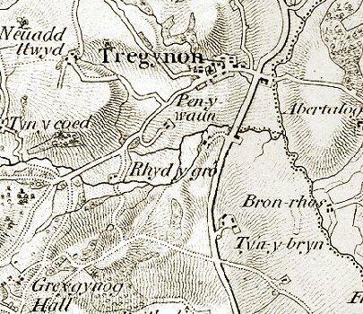
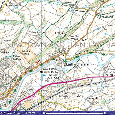
Ordnance Survey map around 1836, 1 inch = 1 mile
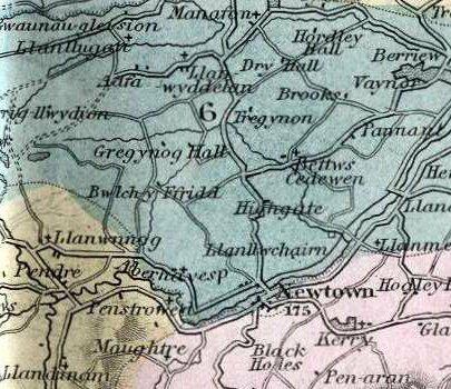
1850 engraved by J. Archer of Pentonville, around 1850. 1 inch = 6 miles
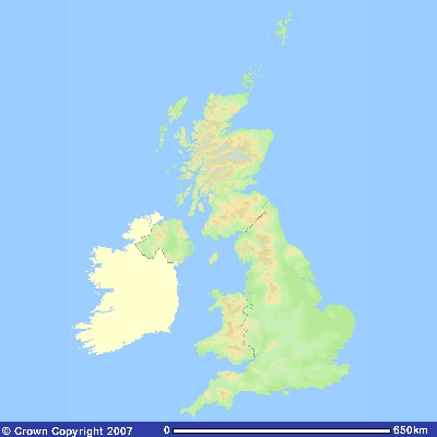 Map of UK |
 Map of Wales |
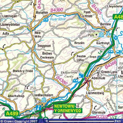
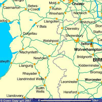 North Powys |
 Montgomeryshire |
 Tregynon 1 |
 Tregynon 2 |
 Gregynog 1 |
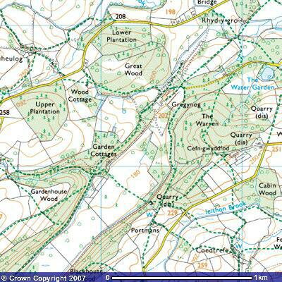 Gregynog 2 |
| Click map to enlarge. Images produced from the Ordnance Survey Get-a-map service and reproduced with kind permission of Ordnance Survey | |||||||
Links to:
- Free UK maps from Ordnance Survey: Get-a-map
- Welsh-English / English-Welsh On-line Dictionary www.geiriadur.net.
- Blayney UK & US Distribution.
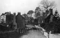 Tregynon Village 1 |
 Tregynon Village 2 |